Hey!
I'm Carston Hernke. I build data pipelines, interactive maps, and the occasional slide deck.
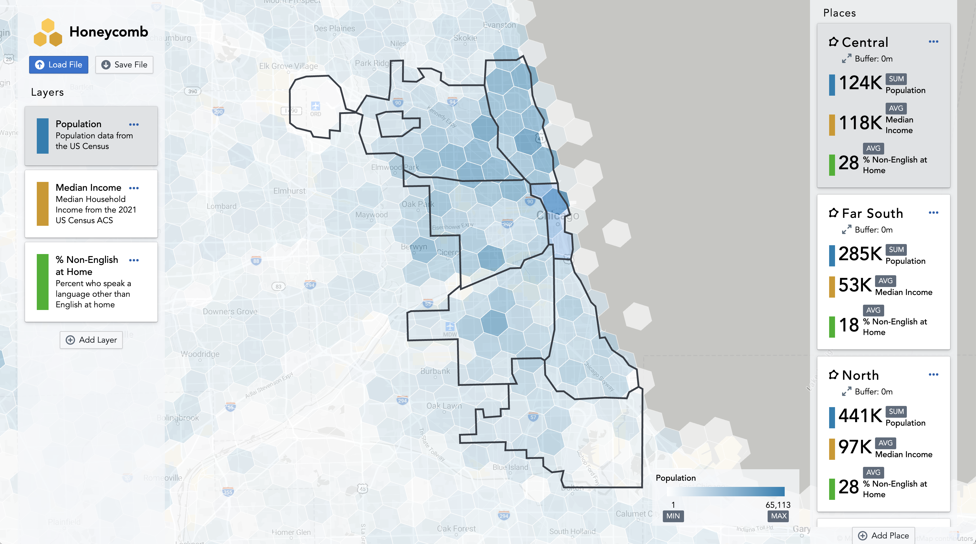
Check out Honeycomb , my latest project!
Feel free to get in touch about jobs, freelance projects, or just coffee: hernk009@umn.edu
Tools to apply styling from CSS (Cascading Style Sheets) to dashboards created in Tableau. Private GitHub repository for copyright reasons - reach out for more information.
For my honors thesis, I used geospatial analysis techniques to find evidence of disparities in access to dockless scooters in Minneapolis, MN.
CSCI 4511W Final Project. Uses various search algorithms to optimize for score, navigating Ms. Pacman towards points and away from ghosts.
An experimental approach to creating cartograms that replace geographic distance with travel time, revealing which places are truly close to each other.
A system designed to track the campus shuttle busses at the University of Minnesota - Twin Cities. Pulls data from the existing NextBus API, cleans and interpolates it, and generates predictions using the scikit-learn machine learning library.
I'm currently available for freelance projects or full-time employment!
I love seeing data projects all the way from idea to execution. My unique experience spanning software development and consulting means I can see all the way from business value to implementation details.
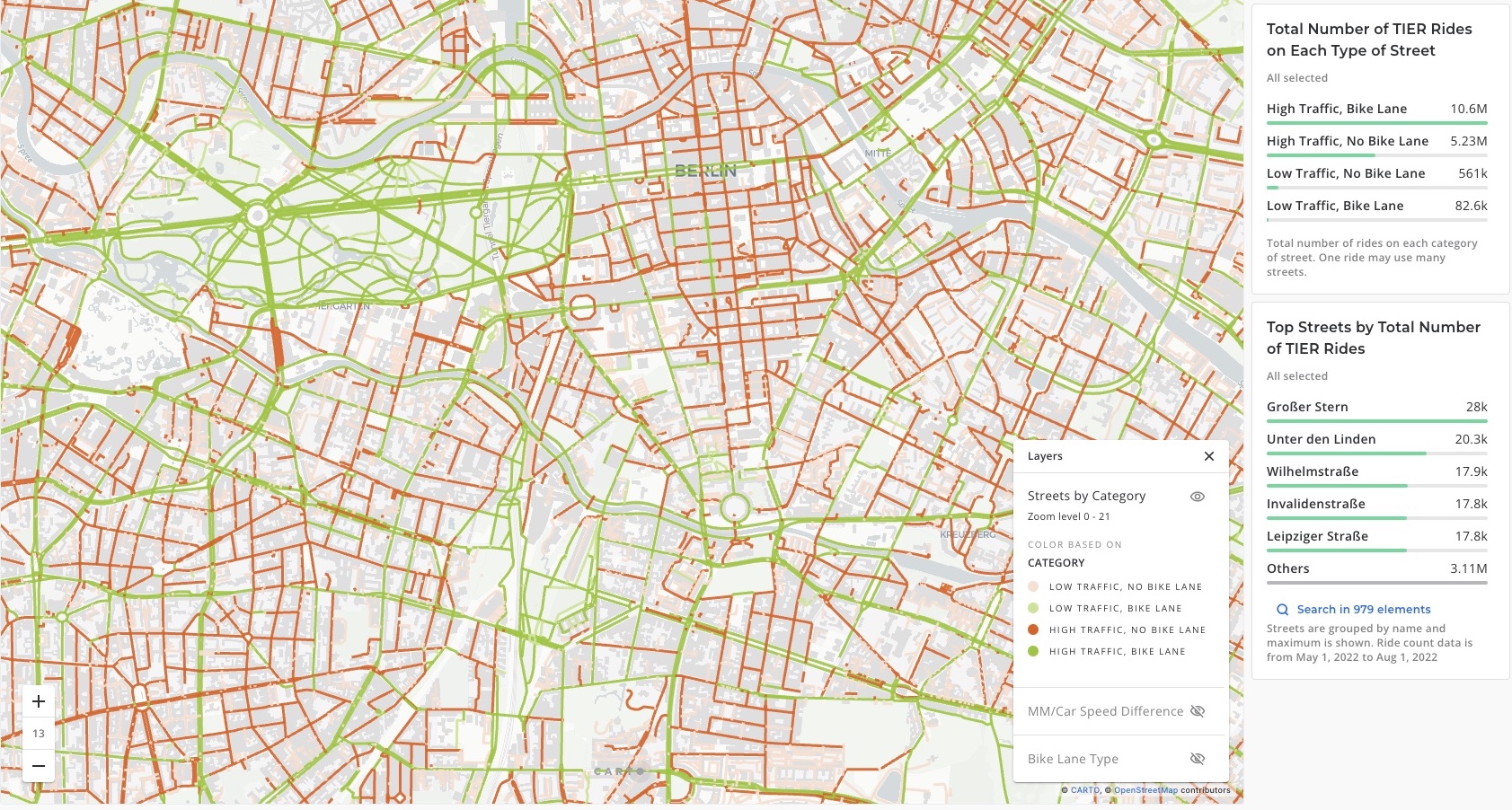
In my latest role, I worked as a Senior Analytics Engineer at TIER Mobility in Berlin, Germany. At TIER, I helped build data products for our partner cities, including Berlin, Paris, and Oslo. One of the projects I'm most proud of is the Bike Lane Analysis, where I combined usage data from our vehicles with Open Street Map data to show cities the gaps in their bike lane networks.
Prior to joining TIER, I was part of the Data & Analytics team at Slalom Consulting. At Slalom, I was a data engineering consultant that worked with digital product teams at a variety of companies.
I have a bachelor's degree from the business school at the University of Minnesota, where I also completed a minor in computer science. For my thesis I analyzed the usage and equity of scooters in the Minneapolis area using geospatial techniques.
When I'm not in front of a computer screen, I enjoy running (check me out on Strava), open-water swimming, and cross-country skiing. I love learning new things and am currently working towards fluency in Norwegian - jeg har en lang vei å gå...
- JavaScript
- Python
- SQL
- Go
- Rust
- Cloud Data Warehouses
- DuckDB
- Deck.gl
- Kafka
- dbt
- Git & Github
- Jekyll
- bash/zsh
- Looker
- Deck.gl
- Carto
- Unfolded
- Superset
- Tableau